The post Training Solutions and Consultancy appeared first on GAS Subsea.
]]>- Geology Consultant
- Seismic Consultant
- Geomechanics Consultant
- Petrophysics Consultant
- Well Engineering Consultants
- Reservoir Engineering Consultants
- Petroleum Engineering Consultants
- Drilling Consultants
- Drilling Services Consultants
- Facilities Engineering Consultants
- Economic Consultants
GAS SUBSEA offers unique assessment consultation and solutions, including assessments combining E&P software with the domain, thus enabling our experts to develop training solutions that combine the industry-leading E&P software tools and workflows with domain learning. The goal is to maximize software proficiency while enhancing domain knowledge to maximize industry opportunities.
Geology Consultant
Exploration for hydrocarbons and their development has become more challenging with each passing decade. Play fairways are more remote, trapping scenarios more complex, reservoir presence and petrophysical characteristics are more difficult to predict with certainty.
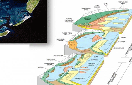
Understanding the geology of the areas of interest becomes more important than ever. The depositional architecture of the sedimentary environments, facies distribution, tectonic evolution and diagenetic history all have an impact on hydrocarbon volume and flow potential.
We attempt to reach this knowledge by combining traditional geological analysis and modern technology to produce robust models that can help in the exploration for new prospects, field development plans and identification of infill opportunities in mature fields.
Geology Services:
Geomodeling, Volumetric analysis, Fractured Reservoirs, Basin Analysis, Sedimentology, Log correlation, Sequence Seismic Stratigraphy, Well Planning, Structural Restoration.
Seismic Consultant
GAS SUBSEA has the expertise to offer end-to-end consulting support in the areas of seismic survey tendering, design, acquisition, and processing services.
We take an independent and rigorous view of contractor performance to provide assessment and advice on tendering and selection. We also have the technical expertise to offer survey design, acquisition, and processing QC services to guide you on the path from concept to geophysical interpretation, quantitative analysis and more.
also offers Site Investigation services: Geo-Hazard or Shallow Hazard Assessment. Integration of specialist geophysical interpretation, geotechnical, geological, and environmental information to identify near surface risks to drilling, pipelines and rig infrastructure
Seismic Services:
Seismic Data Review, Acquisition Modeling, Seismic operations management, Acquisition planning, Processing studies and contractor management, Acquisition Tendering and recommendations, Complex Velocity model analysis, Seismic interpretation, Seismic Inversion, AVO Rock Physics Analysis.
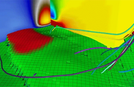
Geomechanics Consultant
Geomechanics is used to analyse drilling risks, pre-drill, during drilling and post-drilling. By integrating technical data from geology, petrophyscis and reservoir engineering data models in 1D, 3D and 4D can be developed that are useful to drilling. Well bore stability is affected by rock stresses that can cause a collapse.
Safe well trajectories can be identified in a 3D geomechanical field and completions can be designed that will withstand production-induced compaction.
At the reservoir level, geomechanical models can be used to analysis pore pressure, fault and top seal integrity, compaction, subsidence, and the effects of injection / depletion on cap rock behaviour.
Geomechanics Services:
Pore pressure analysis, Wellbore stability studies, Reservoir Top seal integrity analysis, Rock Failure Analysis, Stuck pipe assessment, well trajectory modeling, Mud weight and loss assessment, Fault integrity analysis.
Petrophysics Consultant
GAS SUBSEA offers expert petrophysical analysis for exploration, appraisal and development wells including desktop studies, reviews, and real-time interpretation.
Interpretation of petrophysical data can have a profound impact on the volume of hydrocarbons in place and a thorough understanding of the logs is vital. Not only individual log interpretations but the combination of multiple logs in the context of reservoir type (e.g. clastic/carbonate) requires experience and a rigorous approach.
GAS SUBSEA can provide individual interpretations to correlation and analysis of log data which can be built into an audited database of wells. This can be combined with other subsurface data from geophysics, geology and geomechanics to models useful for dynamic modelling and drilling.
Petrophysical Services:
Saturation Hight function analysis, Rock typing & Volumetric, Borehole image analysis, Multiple software Expertise, Thin Bed Analysis, Extensive instrument log analysis, Advanced Interpretation.
Well Engineering Consultants
GAS SUBSEA offers expertise in well engineering for completions design, planning, commercial review, technical appraisal and integration with petroleum engineering and production technology.
Well Engineering is the focal point for completion and well design, well economics, well contract management and well site engineering. The well engineer is needed to optimise well construction, maintenance, intervention, and abandonment operations all of which are high-cost activities. To maintain production subsurface data collection must be planned and carried out. Well test preparation, execution, and monitoring of subsequent well flow in conjunction with other disciplines are vital.
GAS SUBSEA can provide the consulting experience needed to advise on all well engineering activities and act as a key component in the multi-disciplinary teams required for successful projects in exploration, appraisal and development, Porosity and Permeability analysis.
Well Engineering Services:
Well Pad Construction, Well Design, Well Test planning, Well Interventions analysis, Well Abandonment, Completions study, Well Maintenance programs, Engineering Contract Management, Artificial Lift.
Reservoir Engineering Consultants
GAS SUBSEA offers expertise in reservoir engineering for review, dynamic modelling, volumetric assessment, and field development planning.
Reservoir Engineering is where the exploration and appraisal data is built into dynamic modelling analysis to include both fluid and formation information. The importance of calculating the recovery factor and technically recoverable volumes from a field are paramount to both field development planning and investors alike.
GAS SUBSEA can provide detailed dynamic modelling and history matching to forecast future production volumes. Reservoir sweet spot locations and well trajectories for development plans can be planned from dynamic models to maximize the chance of success when drilled.
Reservoir Engineering Services:
Reservoir Simulation, Reservoir connectivity study, Recovery Factor calculation, History matching for future planning, Drill Point planning, Reservoir Driver analysis, Fluid characterization, Flood simulation studies, Well Test Analysis.
Petroleum Engineering Consultants
GAS SUBSEA offers Petroleum Engineering to provide field review, production forecasting and optimization for the best ways to produce a field.
Petroleum Engineering covers a range of subject areas such as field appraisal to understand how a field has been produced historically and what can be done to extend field lifetime and to sustain or improve declining production. By studying production on a field, and incorporating reservoir knowledge, future production can be predicted along with the options such as pumps, injection, artificial lift, workovers, completions, and input to well plans to get the most from the reservoirs.
GAS SUBSEA can provide the expertise to cover the full range of Petroleum Engineering subjects from desktop studies, well planning and through to field review and development planning.
Petroleum Engineering Services:
Increased Oil Recovery, Gas Injection, Water Well Injection, Economic Asset Evaluation, technically recoverable volumes, Thermal Flooding, Carbon capture and storage, Field development planning, estimated ultimate recovery, Reserves based lending assessment, Production Forecasting.
Drilling Consultants
GAS SUBSEA offers expertise in drilling to advise on planning, costing and execution for exploration, appraisal and development wells in cooperation with subsurface and engineering disciplines.
Drilling operations require a detailed appreciation of the geology of formation surrounding the reservoir as well as the type (clastic, carbonate) the target fluid (oil, gas) and the pressures, temperatures, stresses and chemicals (e.g. H2S, CO2) involved. Without this critical information, safe drilling cannot be performed with the appropriate downhole components in place.
GAS SUBSEA can provide the consulting experience needed to advise on drilling operations both onshore and offshore for vertical, deviated, horizontal and multi-laterals.
Drilling Services Consultants
Vertical, Deviated, and Horizontal well design, HPHT Consultancy, Operations and post drill analysis, Safety and risk assessment, Onshore and offshore drilling experience, planning procurement and contract negotiations, Cement and mud services, Planning and workover design, Multiple software expertise.
Facilities Engineering Consultants
GAS SUBSEA offers expertise in facilities to advise on the design and management of pipelines, flowlines compressor stations, gas oil separation plants and related facilities.
Facilities engineering requires a full understanding of field production fluids, pressures, temperatures and flows to design suitable pipelines while avoiding bottlenecks to deliver hydrocarbons to processing plants and stations. Facilities need to be designed conceptually considering health and safety as well as costing and engineering feasibility from pre-FEED to detailed design, construction, commissioning and finally maintaining operation.
GAS SUBSEA can provide the consulting experience needed for facilities review, concept, and feasibility studies, from pre-FEED through to FEED and project management.
Facilities Engineering Services:
Company Representative and Offshore rep. on Major Deep Water.
Project Management and Fabrication management of jackets, piles, spool-pieces, jumpers, and subsea structures (PLEM, PLET, Manifolds, etc).
Quality Advisor on Flexible Flowline Manufacture
Global analysis of subsea structures (PLEM, PLET, Manifolds, etc) and of jackets
Expert witness and engineering consultant in Due Diligence processes
Development of integrity management systems for pipelines and structures and analysis-based inspection programs
Economic Consultants:
Economics involves the application of various techniques to enable economic analysis at every stage in the development of oil and gas exploration and production. The economics of any oil and gas project can be affected by a range of factors. GAS SUBSEA work with economists who can offer expert economic evaluation, risk analysis and financial modelling.
Economists can generate and develop economic models for oil and gas fields, they can help to establish the economic recoverable reserves and the optimization of field development plans.
Our consultants can offer a wide range of economic evaluation techniques for projects such as Red Flag Reviews, Due Diligence projects, Decommissioning, and end of field economics, through to PRMS compliant Competent Person Reports for stock exchange listing.
Economics Services:
Risk Analysis Develop and Generate Economic Models, build financial forecasts, Calculate profitability, Economic Evaluation.
The post Training Solutions and Consultancy appeared first on GAS Subsea.
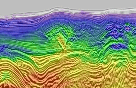
]]>The post Seismic Data Processing appeared first on GAS Subsea.
]]>
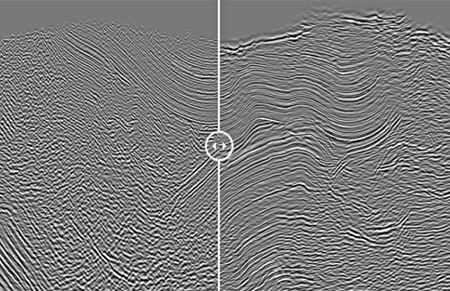
Application-specific seismic data conditioning and processing for confident imaging:
From the field to the final volume, seismic data goes through many processes and workflows. Data conditioning encompasses a wide range of technologies designed to address numerous challenges in the processing sequence—from data calibration and regularization to noise and multiple attenuation and signal enhancement.
Each prestack process and subsequent imaging algorithm must be carefully selected to match your goals and expertly applied.
Each step will affect the fidelity of the final images and, ultimately, your confidence in the results.
Whether you have 2D or 3D data, our algorithms can extend the usable bandwidth of both legacy and new seismic datasets.
This applies to data of any marine acquisition type or technique, including ocean bottom seismic (OBS), multicomponent,
and over-under surveys.
Our research and development professionals are continually developing new technology and workflows for seismic imaging,
as well as enhancing existing ones.
We have the technology, expertise and resources to exceed the highest geophysical processing objectives powered by our proprietary
Imaging software.
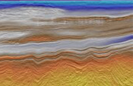
Onshore Processing 2D/3D/4D
Land seismic data processing techniques are divided into two distinct approaches, stratigraphic and structural, and require varying techniques and experience in order to reach the ultimate goal of creating the best image possible.
Absolute Imaging specializes in AVO processing and has written proprietary algorithms to ensure data is amplitude friendly for additional inversion and reservoir characterization work
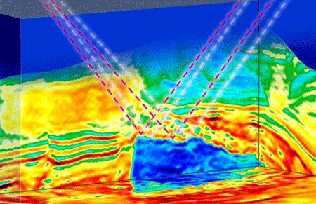
Offshore Processing 2D/3D/4D
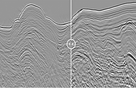
We have advanced marine processing tools and the expertise to deal with the complex marine imaging environment, which ranges from shallow to deep waters.
This includes our ability to match the phase, amplitude and static of various acquisition regimes,
including Transition Zones (TZ).
To tackle different types of multiples we have developed advanced multiple suppression technologies including MWD, SRME, IME and HRRT.
We also have a variety of noise suppression techniques available to deal with linear, swell, erratic and random noise.
To broaden the bandwidth and enhance the interpretability, we have implemented our proprietary shot and receiver de-ghosting techniques in our marine processing.
To aid in proper imaging of the geologic target in either Time or Depth, we have accurate Velocity Analysis and advanced APSTM and APSDM imaging technologies with various migrators such as Kirchhoff, Advanced BEAM, WEM & RTM.
All of the above technologies are available for towed streamer and OBN/OBC data.
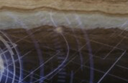
Multicomponent Processing
Unconventional tools and a careful, thoughtful approach to processing are needed to
successfully produce interpretable multi-component products.
Absolute Imaging has developed the specialized algorithms and expertise to effectively process these unique
datasets.
- Polarization filtering, and other specialized pre-stack noise suppression techniques
- Field orientation analysis and vertical orientation rotation
- Horizontal rotation to radial/transverse or P-S1/P-S2 orientation
- Solving the shear wave receiver statics problem
- Multicomponent moveout – Slotboom NMO
- A layer stripping approach to shear-wave splitting estimation and compensation
- Common Conversion Point (CCP) binning
- Multicomponent post and pre-stack time migration
Our Services in Action: Explore Our Gallery
The post Seismic Data Processing appeared first on GAS Subsea.
]]>We use high-quality and reliable pipeline and flowline inspection methods to verify subsea asset integrity.
The post Geophysical ﹠ Hydrographic appeared first on GAS Subsea.
]]>- Project planning and management
- Data solutions & Processing and analysis
- Experienced Personnel
- Pipeline inspection
- Drone Based Surveying
- LIDAR
Project planning and management
providing expertise on survey program development, management and technical solutions.
-
-
- Project Planning.
- Project Management.
- Technical Consulting.
- Quality Control.
- On-site Representation.
-
Data solutions & Processing and Analysis
Gyoscience and Hydrographic survey data solution, data processing during project cycle.
-
-
- Geophysical data Processing & Interpretation.
- Hydrographic Survey data Processing & analysis.
Ground Model Development.- Data QA/QC Services.
- Cloud based data management and hosting.
- GIS and Mapping services.
- Geoscience/Geohazard Reporting Services.
-

Experinced Personnel
Quality office and field-based staff with extensive experience in Oil & Gas and renewable industry for our client’s needs.
-
-
- Project Managers.
- Survey Party Chiefs.
- Hydrographic & Construction Surveyors.
- Survey Engineers.
- Survey Data Processors.
- Subsea Inspection Coordinators.
-
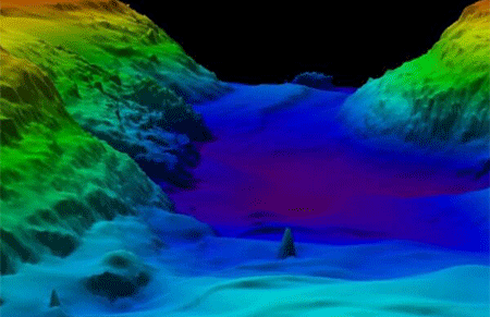
Geophysical & Hydrographic Surveys:
- Our geophysical surveys explore all dimensions of the seabed using the latest technologies and modern expertise. Using precisely positioned magnetometers, sub-bottom and side scan sonar to image the seabed surface and sub-surface.
- High Resolution Multi-beam Survey.
- Our hydrographic surveyors have the capability to inspect seafloor conditions, investigate underwater obstructions, and serve as an underwater set of eyes for search, rescue, and recovery operations. Using gathered data.
- Our professionals create detailed models of rivers, lakes, bays, and the ocean seafloor. Regardless of vessel type or project site.
- Our professionals are capable of producing detailed maps, digital imagery, and video graphics from field and office locations.
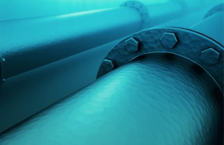
Pipeline inspection:
We use high-quality and reliable pipeline and flowline inspection methods to verify subsea asset integrity.
Drone based surveying:
Drone mapping by taking pictures of the field below at a regular interval. Afterwards, the pictures are stitched together into one giant image of the field.
LIDAR:
3D mobile lidar can be paired with georeferenced photography to accurately image and record natural and man-made structures before and after construction or a natural disaster.
The post Geophysical ﹠ Hydrographic appeared first on GAS Subsea.
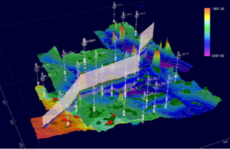
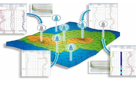
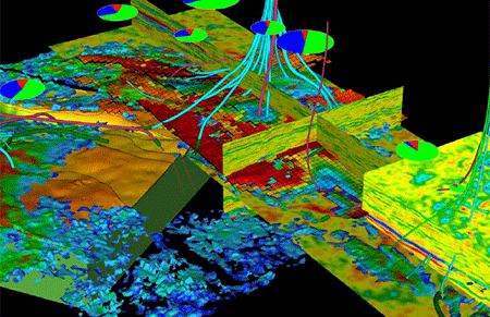
]]>Increase your chances of success while screening new prospects, identifying potential drilling hazards, evaluating mature fields, or looking for the best location to place your next well. Our integrated reservoir characterization services incorporate geological, engineering, and seismic data for a detailed and succinct understanding of the subsurface.
The post Geological and Geophysical appeared first on GAS Subsea.
]]>- Reservoir Characterization
- Field Development & Production Optimization
- Geoscience digitalization Services
- Wellsite Services
- Quality-assured techniques and integrated services at our state-of-the art facilities.
- Find comprehensive solutions for your natural resource exploration, development, and production challenges with a full scope of geoscience data, knowledge, and capabilities.
Reservoir Characterization
Enhance understanding of reservoir behavior
Increase your chances of success while screening new prospects, identifying potential drilling hazards, evaluating mature fields, or looking for the best location to place your next well. Our integrated reservoir characterization services incorporate well geological, engineering, and seismic data for a detailed and succinct understanding of the subsurface.
Get an integrated approach to reservoir characterization for:
-
-
- Shortened project timelines, helping to accelerate decision-making.
- Simplified contracting processes.
- Maximized knowledge transfer between disciplines.
- The best possible answer from all available data.
-
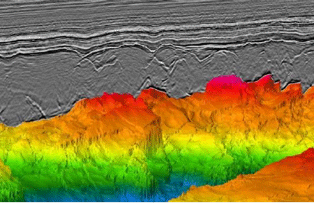
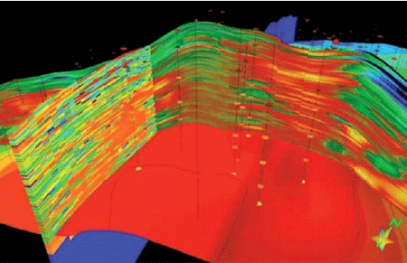
Seismic Workflow:
We integrate our seismic expertise into tailored reservoir characterization projects, including:
-
-
- Petrophysics and rock physics modeling.
- Reservoir-focused seismic enhancement.
- AVO analysis.
- Seismic inversion.
- Seismic attribute analysis.
- Seismic pore pressure prediction.
- Seismic lithology and facies classification.
- Seismic interpretation.
- Seismic sequence stratigraphy.
-
Geological Workflow:
Using our wide-ranging technology and expertise in clastic and carbonate sedimentology, formation evaluation, and reservoir quality characterization and predictability, we adopt integrated geological problem solving across a range of disciplines to reduce uncertainty. Our solutions cover a range of scales, from assessing micro- to macro-scale reservoir distribution and reservoir quality challenges in conventional and unconventional petroleum reservoirs, site characterization and de-risking, basin-scale source-to-sink studies, play fairway mapping, and conditioning of reservoir models. Our wide-ranging services include:
-
-
- Stratigraphy, including bio-, chemo-, and litho-stratigraphy.
- Fully integrated quantitative petrography services and integrated reservoir quality analysis of all sample types: core plugs, sidewall cores, outcrop samples, loose sediments, and cuttings.
- Single and multi-disciplinary studies; pore-to-seismic scale reservoir characterization.
- Clastic and carbonate sedimentology including detailed core description, facies analysis and mapping.
- High-resolution thin section imaging for digital thin section archiving and machine-learning (ML) led quantitative bulk mineralogy assessment, porosity analysis, and grain segmentation on newly acquired and legacy thin sections.
- Depositional and diagenetic models.
- Well log interpretation, petrophysical formation evaluation, electrofacies characterization and prediction, and well correlations.
- Integrated organic geochemistry: source rock screening, maturity analysis, and petroleum system/basin modeling.
- Stratigraphic forward modeling.
- Regional drainage analysis and provenance studies.
- Basin-to regional scale mapping (integrated mapping).
- Play fairway maps.
- Generation of accurate, standardized, and reproducible datasets and digitization of legacy data and geological data management.
-
Petrophysical Workflow:
We integrate log, core/cuttings, and production data to obtain physical properties such as mineralogy, porosity, permeability, and fluid saturations. The goal is to assess accurate reservoir rock and fluid properties at well locations to be integrated with seismic data and its derivatives. Our services include:
-
-
- Petrophysical conditioning of log data.
- Formation description logs (FDLs).
- Reservoir rock-typing (RRT).
- Rock physics modeling.
-
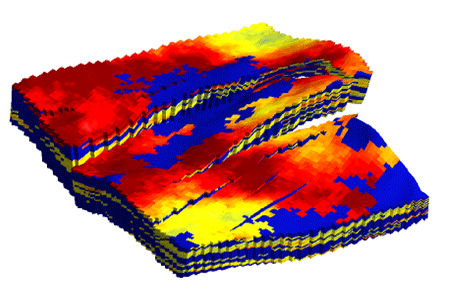
Geomodelling Workflow
Gas Subsea has enormous experience in building integrated geological static reservoir models for dynamic flow simulation. Access to state-of-the-art reservoir imaging, geological and petrophysical workflows complements our capabilities in model-building
and flow simulation. Our services include:
-
-
- Static modeling.
- Dynamic modeling.
- Simulation.
- Production profile prediction.
- History matching covering black oil, heavy oil, gas condensate and gas fields.
- All reservoir types: clastic, carbonate and fractured reservoirs.
-
Leads and Prospects Generation:
Gas Subsea has global experience performing prospectivity studies at all scales, from frontier areas to mature basins.
- Play fairway analysis to evaluate charge, reservoir and seal:
This work begins with in-depth geochemistry and petroleum systems analysis, reservoir stratigraphy and sedimentology, and seismic interpretation and structural interpretation. A Gas Subsea prospectivity study can also leverage global database insights on paleogeography, paleoclimate, and geological analogues, integrating available multi-physics data, regional geological information, post well analysis, geological analogues, and regional statistical data. The play analysis is then brought together through play component mapping, Composite Common Risk Segment (CCRS) mapping, play chance calculations and yet-to-find estimation, creating a compelling picture of the play risks and the location of exploration “sweet spots.”
- Block evaluation:
We build a ranked portfolio, based on value, of identified leads and prospects, integrated with complementary methods such as sequence stratigraphy, sedimentology, structural restoration, fault seal analysis, seismic attribute and inversion, and petroleum systems modeling, to support future business decisions. This evaluation provides a complete volume and risk assessment for each opportunity that highlights the key risks, uncertainties, and sensitivities.
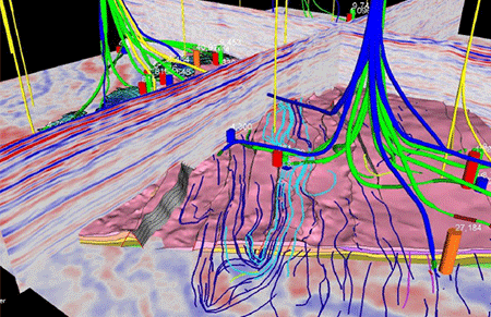
Field Development & Production Optimization Services
Static Model Building:
Gas Subsea’s specialist geomodelling department is supported by world-class seismic, sedimentological, stratigraphic, GIS mapping, petrophysical and reservoir engineering personnel. The geological model is the place where all these data are integrated and made sense of. We focus on providing clients with the big picture based on quality inputs, while all the time keeping a strong focus on their ultimate aims. Our geological models are used as the basis for dynamic reservoir simulations and fully independent FDPs (field development plans) and advice. Our experienced economics department can advise on FDP optimization, asset value and financial risk.
The main components of our static model building workflow and methodology are:
-
-
- Data loading, expert QC, and analysis.
- Integration of regional, sedimentological, diagenetic, petrophysical and reservoir architectural understanding.
- Incorporation of sedimentological, seismic, petrophysical and reservoir engineering data.
- Structural modeling.
- Facies and reservoir property modeling.
- Saturation modeling and QC.
- Volumetric determinations and uncertainty analysis.
- Migration-to-reservoir simulator and initialization support.
-
Classical Reservoir Engineering
Gas Subsea’s Reservoir Sciences group is well versed with use of analytical reservoir engineering techniques and puts special emphasis on harnessing the results from analytical methods with static and dynamic modeling workflows. Our experts utilize industry-accepted software and in-house analytical tools to conduct their analyses. At GAS SUBSEA, we appreciate that each reservoir has unique issues, so our experts use tailored workflows to address these and meet our clients’ needs.
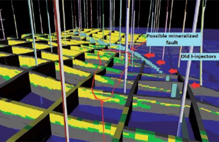
Dynamic Modeling:
Gas Subsea has the capability to simulate very large, high-resolution dynamic models with fine grids utilizing workflows tailored for assets at different stages of the E&P life cycle. Our experts use the industry-standard commercial simulation platforms and have global experience in dynamic modeling of complex carbonate and clastic reservoirs with a variety of reservoir fluids. They can recommend optimized field development plans under primary, secondary, and tertiary recovery schemes. Gas Subsea also utilizes a new proprietary ensemble-based history-matching workflow to condition static models to production data so that they are more detailed and realistic, and to refine history-matching results.
Surface Modeling & Economics
Once the dynamic reservoir properties have been generated, Gas Subsea can now conduct well- and field-level optimization studies to help clients select the best interface between reservoir and surface facility. Key components of this solution will be:
-
-
- Completion design.
- Artificial lift design and optimization.
- Flow assurance.
- Metallurgy selection.
- Corrosion assessment.
- Well performance (vertical lift curves).
- Production system flow.
- Pipeline geometry.
- Separator pressures.
- System constraints and GAP analysis.
-
After the production forecasts have been generated, cost profiles are created for operating costs (OPEX) and capital costs (CAPEX) as well as abandonment costs. The project can be optimized for the commercial terms and product prices:
-
-
- Modeling of fiscal terms and the creation of an economics model.
- Economics model outputs will be cash flow, NPV, rate of return, EMVs (for exploration and prospects) and other metrics as required.
- Analysis of the economics model outputs to select the optimum development scenario.
-
Assessing mechanical properties
Get greater insight into the key role of geomechanical effects across the development and production cycle. Coupled reservoir-geomechanical simulation and specialist studies include:
-
-
- Wellbore and casing integrity analysis.
- 1D and 3D Pore Pressure Prediction (PPP) and Mechanical Earth Model (MEM) studies.
- Full field compaction/subsidence and heavy modeling.
- Waterflood, PWRI, CRI EOR and waste injection modeling.
- Fault reactivation modeling.
- Sand production and cavity propagation modeling.
- Numerical and analytical PTA/RTA and mini-frac analysis.
-
Applications for specific scenarios include:
-
-
- Thermal projects from heavy oil SAGD production to CCS injection.
- Tar sand heavy oil surface heave, caprock integrity and MOP.
- Injection into soft/unconsolidated reservoirs.
- Naturally fractured reservoir development.
- Shale plays and tight formation well completion, stimulation and interference.
- Geothermal resource development.
- CCS injection and storage.
- Integration of multi-disciplinary data, including reservoir simulation, 4D seismic, seismic attribute extractions, structure model, and production data.
-
Geoscience digitalization Services
Data Management Services:
GAS SUBSEA has expertise in migrating multi-discipline data from third-party databases into a common platform which can be accessed by other technical consultants. This is important if project data is locked away in inaccessible third-party databases.
By accessing and bringing datasets together, a wide range of experts can become aware of all data held for a project from a range of disciplines. This has the key benefit of promoting inter-disciplinary collaboration and an overview of data for more informed decision-making and project management.
-
-
- Inter-disciplinary data awareness.
- Migrate inaccessible data.
- Promote Inter-Discipline Collaboration.
- Improve complex problem-solving.
- Hold multi-discipline data set in one accessible platform.
- Improve Decision making and planning.
- Expand expert input into problem solving.
-
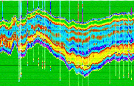
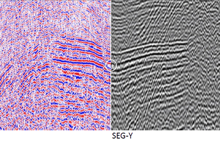
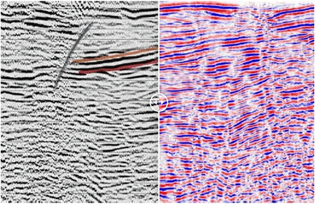
Seismic Data Vectorization:
Seismic vectorizing quality varies widely across the industry. Although some vectorized SEG-Y files may initially appear acceptable, they will often be missing much of the underlying data. Gas Subsea’s SEG-Y output derives from newly developed vectorizing software with several new techniques.
-
-
- We use image editing software specifically designed for large images and can consolidate multiple seismic images into one section.
- Image markings or hand-drawn interpretation are edited out before capturing the underlying seismic.
- Shot point and CMP data is recorded.
- Extra EBCDIC information is typed from the label (if it exists).
- Our software predicts the invisible positive overlap of the peaks and tracks the negative trough wiggle lines.
- Each trace is bandpass filtered (outside the original frequency range) and amplitude balanced across the whole trace.
- Navigation information can be added to the SEG-Y files for easier loading.
-
Seismic Displays:
-
-
- Most colour sections can be accurately digitized to SEG-Y. Common examples of this display type include greyscale, black-red and blue-red.
- Gas Subsea offers high quality seismic reconstruction to SEG-Y from most image sources: photographs, desktop A4 scanned images, computer screen-captured images, data room images, CGM, JPEG, PNG image files etc., all the way up to high resolution large scale seismic hardcopy or plots. Seismic type displays such as Vertical Seismic Profiles (VSPs), EPC and ocean bottom surveys can also be digitized.
-
Interpretation Removal:
-
-
- An extensively interpreted seismic image converted to SEGY using our Fill Interpolation Filter.
- Interpretation normally persists in screenshot image capture, but with Fill Interpolation we can remove it from the SEGY.
-
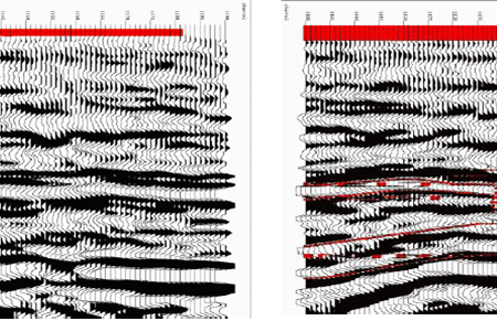
Image Recovery:
Most clean-up work is included within the seismic vectorization process. However, in some cases seismic sections may be extensively marked or have significant drawing interpretation over them. If that is the case, extra time may be required to clean these images before digitizing.
The final seismic reconstruction is promptly returned inside oil and gas industry
 standard SEG-Y format files, accompanied with a comprehensive report spreadsheet.
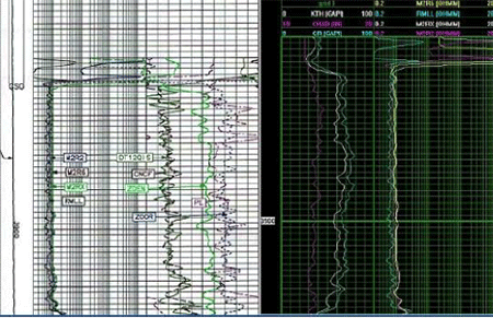
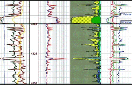
Well Logs Digitization:
-
-
- We can digitize the well log data from Standard Wireline Logs, Russian Style Format Logs, Mud Logs, Gas Logs and ‘Tadpoles’.
- Logarithmic, hybrid, linear and reciprocal scales are all recorded.
- Curves of a well are spliced and can be composited if required (including Depth Matching/Shift).
- Additional well Log header metadata can be captured.
- The digital data is delivered in LAS and LIS formats.
-
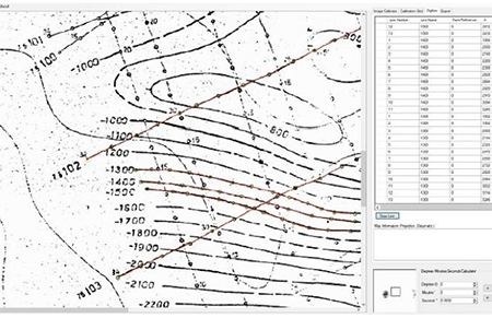
Map Digitizing:
Should digital navigation data not already exist, it can be captured from base-map images. We use a leading map digitizing package which enables us to capture this information and convert it between all common projection systems. Shot-points, wells, contours, boundaries, and faults etc. can all be captured. Similarly, we can capture elevation information from seismic sections and load it into the vectorized SEG-Y trace headers.
Wellsite Services
Real-time wellsite support for geosteering, geostopping and geomapping-while-drilling. We support the life cycle of your drilling project with:
-
-
- Highly experienced wellsite technicians, biostratigraphers and sedimentologists.
- Logistics and planning for mobile wellsite onshore/offshore laboratories and equipment.
- Post-drill integrated expertise from finite-scale scanning electron microscopy to basin-scale regional seismic evaluation.
-
Advanced expertise available at the wellsite
Supported by our leading thin section & microscopy laboratories, our multi-disciplinary laboratory teams take the laboratory to wellsite, supporting geoscientists with integrated, tailored techniques:
-
-
- Wellsite biostratigraphy.
- Wellsite micropaleontology.
- Wellsite nannopaleontology.
- Wellsite palynology (acid & enhanced non-acid).
- Wellsite reservoir petrography.
- Wellsite lithostratigraphy.
- Wellsite elemental chemostratigraphy (XRF).
-
The post Geological and Geophysical appeared first on GAS Subsea.
]]>The post Engineering and Petroleum Development appeared first on GAS Subsea.
]]>- Fluid System Analysis
- Fluid System studies
- Reserves Certification and Valuation
- Geological and Static Data Analysis
- Dynamic Reservoir Engineering
- Facilities Costing & Economics
- Asset evaluation
- Drilling Services
Fluid Systems Analysis
De-risk exploration with better understanding of fluid system elements
Gas Subsea has developed comprehensive fluid systems analysis capabilities, for exploration of petroleum, hydrogen, and helium, as well as contributing to geothermal and CCUS, ensuring close collaboration. Our integrated approach ensures we can tailor projects to project-specific needs and challenges, leveraging a wide-range of expertise:
-
-
-
-
-
-
- 1D, 2D and 3D basin modeling using industry-standard software
- Multi-phase and multi-species fluid behavior.
- Source facies and fluid bulk properties.
- Integrated, in-house capabilities; geophysics, geoscience, geochemistry, sedimentology, stratigraphy, and rock physics-petrophysics-seismic inversion.
- Establish the presence and effectiveness of conventional and unconventional reservoirs, source faciesand character, seal, and trap for a host of sub-surface fluids (hydrocarbons, hydrogen, helium, geothermal and CCUS)
- Characterize reservoir effectiveness by looking at the type, quality, extent, and connectivity in relation to a host of sub-surface fluid types.
- Ascertain the processes of diagenesis that alter the reservoir following deposition.
- Study your seal to understand the integrity and column height potential using fault seal analysis, sedimentology, and basin modeling techniques.
- Characterize your source rock facies and generation processes to better understand extent, thermal history including transformation and estimated expulsion compositions and volume distributions (multi-fluid and phase).
- Improve understanding of the trapping mechanism and controls on column height distributions of your fluid system.
-
Characterize the full fluid system
Fluid Systems studies
Develop E&P assets confidently with accurate subsurface knowledge.
Maximize field potential and optimize production by starting with a comprehensive geological understanding. GAS SUBSEA field development consultancy services, which include fully integrated static and dynamic model building, seismic inversion, and other data-enhancing workflows, help you model the best scenarios for optimal production.
-
-
 Key Expertise to help maximize asset value.
-
-
- Structural and petroleum geology
- Geochemistry
- Geophysics
- Geomechanics
- Sedimentology
- Seismic reservoir characterization
- Petrophysics
- Reservoir engineering
- Petroleum engineering
- Facilities engineering
Reserves Certification & Valuation
Trusted multi-disciplinary advice to support your strategic decisions.
Gas Subsea has a long history of providing high-quality reserves certification & valuation services, from fast evaluations for time-critical M&A decisions to detailed reserves assessment studies and field development planning. We have provided Reserves Certification and Competent Persons Reports (CPR) to AIM and LSE listed companies. Our valuation services cover the whole of the valuation chain, from exploration blocks to mature producing fields, both onshore and offshore.
-
 Reporting and reserves certification
-
- Reserves and economics evaluation and reporting (SEC, SPE PRMS) for stock market listing, and project and bank finance.
- Competent persons report (CPR) for company right issues and for stock market flotation and listing.
Geological & Static Data Analysis
We tailor our workflows to our clients’ needs, considering the nature of the asset and the available data, to deliver enhanced subsurface understanding that supports strategic decisions. We bring a huge range of regional knowledge and technical expertise to achieve this:
All the available regional and field-specific geological, geophysical and petrophysical data is reviewed, analyzed, and integrated to increase understanding and mitigate risk for the target sequence, license block or farm-in opportunity.- A clear structural and stratigraphic framework is developed and used to map existing discoveries and potential traps.
- Workflow deliverables include a range of in-place volumes and the associated geological risks.
Dynamic Reservoir Engineering
We provide expertise in classical reservoir engineering disciplines and analysis, including material balance, well test analysis and nodal analysis for our dynamic model building and reservoir engineering workflows:
- Equation of state modeling
- Pressure surveys: RFT, MDT, XPT
- Transient test modeling
- Material balance
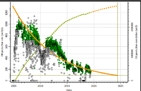
- Decline curve analysis.
- Inflow – outflow performance analysis
- The available dynamic data is reviewed, analyzed, and integrated with the static data and model by our experienced reservoir engineers. Standard deliverables from the dynamic reservoir
modeling will include: - Recoverable volumes and recovery factors (RF)
- Production forecasts based on a selection of development scenarios.
Facilities Costing & Economics
Once the production forecasts have been generated, our petroleum economists generate cost profiles for operating costs (OPEX), capital costs (CAPEX) and abandonment costs. An economics model based on the fiscal terms is created and used to model cash flow, NPV, rate of return, EMV (for exploration and prospects) and any other operational economic metrics required. These form the basis of our reporting deliverables:
- Reserves and economics reporting (SEC, SPE PRMS)
- Reserves evaluation reports for project and bank finance
- Competent Persons Report (CPR) for company right issues and for stock market flotation and listing
- Public domain studies and valuations
- Bank and project finance.
Asset evaluation
- Exploration license round economics, evaluations and bid advice.
- Exploration and appraisal technical and commercial evaluations.
- Field commercialization studies.
- Asset acquisition, farm-in and divestment evaluation, support and advice.
- Rapid company merger and acquisition (M&A) evaluations.
Drilling services
GAS SUBSEA offers expertise in drilling to advise on planning, costing and execution for exploration, appraisal, and development wells in cooperation with subsurface and engineering disciplines.
Drilling operations require a detailed appreciation of the geology of formation surrounding the r- Vertical, Deviated, and Horizontal well design.
- HPHT Consultancy, Operations, and post drill analysis.
- Safety and risk assessment.
- Onshore and offshore drilling experience
- planning procurement and contract negotiations.
- Cement and mud services, Planning, and workover design.
- Multiple software expertise.
-
-
The post Engineering and Petroleum Development appeared first on GAS Subsea.
]]>The post Pipeline inspection appeared first on GAS Subsea.
]]>We use high-quality and reliable pipeline and flowline inspection methods to verify subsea asset integrity.
Drone based surveying:
Drone mapping by taking pictures of the field below at a regular interval. Afterwards, the pictures are stitched together into one giant image of the field.
LIDAR:
3D mobile lidar can be paired with georeferenced photography to accurately image and record natural and man-made structures before and after construction or a natural disaster.
The post Pipeline inspection appeared first on GAS Subsea.
]]>