Geophysical ﹠ Hydrographic
Project planning and management
providing expertise on survey program development, management and technical solutions.
-
-
- Project Planning.
- Project Management.
- Technical Consulting.
- Quality Control.
- On-site Representation.
-

Data solutions & Processing and Analysis
Gyoscience and Hydrographic survey data solution, data processing during project cycle.
-
-
- Geophysical data Processing & Interpretation.
- Hydrographic Survey data Processing & analysis.
Ground Model Development.- Data QA/QC Services.
- Cloud based data management and hosting.
- GIS and Mapping services.
- Geoscience/Geohazard Reporting Services.
-

Experinced Personnel
Quality office and field-based staff with extensive experience in Oil & Gas and renewable industry for our client’s needs.
-
-
- Project Managers.
- Survey Party Chiefs.
- Hydrographic & Construction Surveyors.
- Survey Engineers.
- Survey Data Processors.
- Subsea Inspection Coordinators.
-
Geophysical & Hydrographic Surveys:
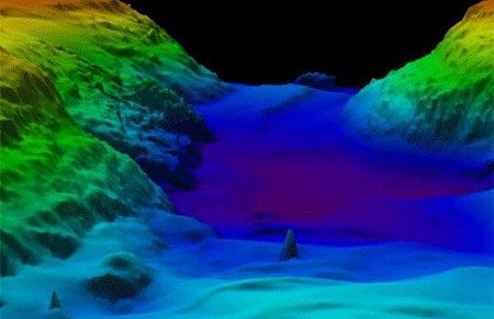
- Our geophysical surveys explore all dimensions of the seabed using the latest technologies and modern expertise. Using precisely positioned magnetometers, sub-bottom and side scan sonar to image the seabed surface and sub-surface.
- High Resolution Multi-beam Survey.
- Our hydrographic surveyors have the capability to inspect seafloor conditions, investigate underwater obstructions, and serve as an underwater set of eyes for search, rescue, and recovery operations. Using gathered data.
- Our professionals create detailed models of rivers, lakes, bays, and the ocean seafloor. Regardless of vessel type or project site.
- Our professionals are capable of producing detailed maps, digital imagery, and video graphics from field and office locations.

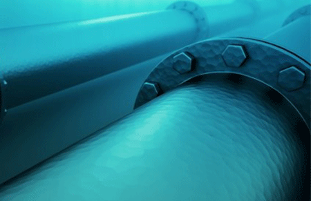
Pipeline inspection:
We use high-quality and reliable pipeline and flowline inspection methods to verify subsea asset integrity.
Drone based surveying:
Drone mapping by taking pictures of the field below at a regular interval. Afterwards, the pictures are stitched together into one giant image of the field.
LIDAR:
3D mobile lidar can be paired with georeferenced photography to accurately image and record natural and man-made structures before and after construction or a natural disaster.

